NATIONAL WEATHER SERVICE SEVERE WEATHER UPDATE FOR THURSDAY, MARCH 18
The North Myrtle Beach area should begin to see storm-related weather this afternoon and ending early tonight. Our greatest chance for severe weather is expected between 4:00 pm and 8:00 pm
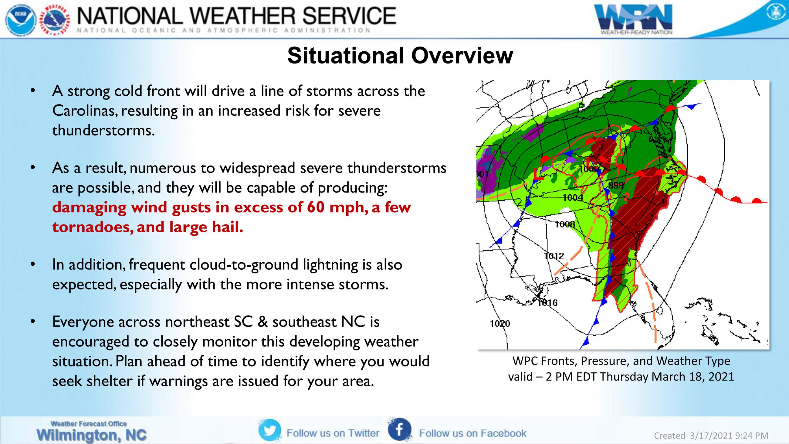
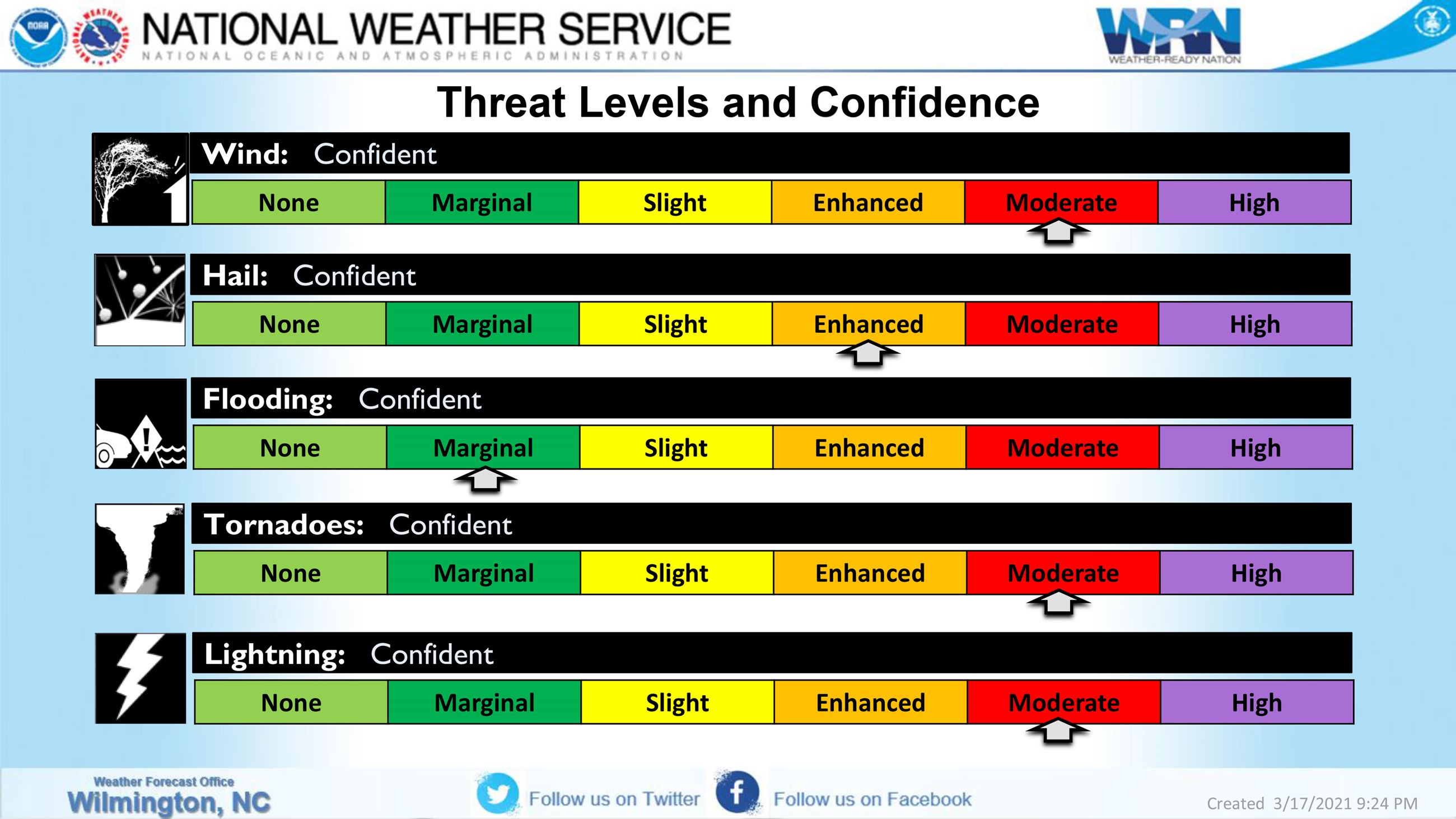
-- High confidence of a multi-hazard severe weather event with potential impacts from damaging wind gusts in excess of 60 mph, tornadoes, and some large hail.
-- Generally, the threat will be greatest from the early afternoon for inland areas, and later in the afternoon into the evening for coastal locations.
-- Hazardous maritime conditions are expected to develop today in the fetch ahead of the front, and especially as the line of thunderstorms moves across the adjacent waters this evening.
-- Everyone in northeast SC and southeast NC should review their severe weather plan, and be prepared to take shelter if warnings are issued for your area.